Object
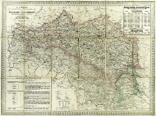
Title: R. A. Schulz's General Post- und Strassenkarte von Galizien und Lodomerien mit Auschwitz, Zator und Krakau so wie des Kronlandes Bukowina
Subtitle:
General Post- und Strassenkarte von Galizien und Lodomerien mit Auschwitz, Zator und Krakau so wie des Kronlandes Bukowina ; Karte von Galizien
Publisher:
Place of publishing:
Description:
Scale 1:864 000 ; 1 map : lithogr., hand col. ; 56x64 cm, folded in cover 20x14 cm ; Prime meridian [Ferro] ; On the map there are " Politische Einleitung und statistische Übersich" and "Gerichtliche Eintheilung"
Detailed Resource Type:
Format:
File size 6,3 MB ; image/x.djvu
Resource Identifier:
Source:
CBGiOŚ. IGiPZ PAN, call no. PTG D.270 [II.3B-2] ; CBGiOŚ. IGiPZ PAN, call no. D.8051 [II.3B-1] ; click here to follow the link
Language:
Rights:
Terms of use:
Digitizing institution:
Institute of Geography and Spatial Organization of the Polish Academy of Sciences
Original in:
Projects co-financed by:
Programme Innovative Economy, 2010-2014, Priority Axis 2. R&D infrastructure ; European Union. European Regional Development Fund
Access:
Object collections:
- Institute of Geography and Spatial Organization PAS (IGiPZ PAN) > Library
- Institute of Geography and Spatial Organization PAS (IGiPZ PAN) > Library > Maps and atlases
- Institute of Geography and Spatial Organization PAS (IGiPZ PAN) > Library > Selected collections > Polish Geographical Society Collection
Last modified:
Oct 2, 2020
In our library since:
Sep 1, 2011
Number of object content downloads / hits:
2733
All available object's versions:
https://www.rcin.org.pl/igipz/publication/6047
Show description in RDF format:
Show description in RDFa format:
Show description in OAI-PMH format:
Objects Similar
Liechtenstern, Joseph Marx von (1765–1828) Stöber, Joseph (1768–1852)
Gotz, Marceli. Litogr.

 INSTYTUT ARCHEOLOGII I ETNOLOGII POLSKIEJ AKADEMII NAUK
 INSTYTUT BADAŃ LITERACKICH POLSKIEJ AKADEMII NAUK
 INSTYTUT BADAWCZY LEŚNICTWA
 INSTYTUT BIOLOGII DOŚWIADCZALNEJ IM. MARCELEGO NENCKIEGO POLSKIEJ AKADEMII NAUK
 INSTYTUT BIOLOGII SSAKÓW POLSKIEJ AKADEMII NAUK
 INSTYTUT CHEMII FIZYCZNEJ PAN
 INSTYTUT CHEMII ORGANICZNEJ PAN
 INSTYTUT FILOZOFII I SOCJOLOGII PAN
 INSTYTUT GEOGRAFII I PRZESTRZENNEGO ZAGOSPODAROWANIA PAN
 INSTYTUT HISTORII im. TADEUSZA MANTEUFFLA POLSKIEJ AKADEMII NAUK
 INSTYTUT JĘZYKA POLSKIEGO POLSKIEJ AKADEMII NAUK
 INSTYTUT MATEMATYCZNY PAN
 INSTYTUT MEDYCYNY DOŚWIADCZALNEJ I KLINICZNEJ IM.MIROSŁAWA MOSSAKOWSKIEGO POLSKIEJ AKADEMII NAUK
 INSTYTUT PODSTAWOWYCH PROBLEMÓW TECHNIKI PAN
 INSTYTUT SLAWISTYKI PAN
 SIEĆ BADAWCZA ŁUKASIEWICZ - INSTYTUT TECHNOLOGII MATERIAŁÓW ELEKTRONICZNYCH
 MUZEUM I INSTYTUT ZOOLOGII POLSKIEJ AKADEMII NAUK
 INSTYTUT BADAŃ SYSTEMOWYCH PAN
 INSTYTUT BOTANIKI IM. WŁADYSŁAWA SZAFERA POLSKIEJ AKADEMII NAUK


