- O repozytorium
- Kolekcje
- Indeksy
- Historia przeglądania
-
Repozytoria RCIN
-
 INSTYTUT ARCHEOLOGII I ETNOLOGII POLSKIEJ AKADEMII NAUK
-
 INSTYTUT BADAŃ LITERACKICH POLSKIEJ AKADEMII NAUK
-
 INSTYTUT BADAWCZY LEŚNICTWA
-
 INSTYTUT BIOLOGII DOŚWIADCZALNEJ IM. MARCELEGO NENCKIEGO POLSKIEJ AKADEMII NAUK
-
 INSTYTUT BIOLOGII SSAKÓW POLSKIEJ AKADEMII NAUK
-
 INSTYTUT CHEMII FIZYCZNEJ PAN
-
 INSTYTUT CHEMII ORGANICZNEJ PAN
-
 INSTYTUT FILOZOFII I SOCJOLOGII PAN
-
 INSTYTUT GEOGRAFII I PRZESTRZENNEGO ZAGOSPODAROWANIA PAN
-
 INSTYTUT HISTORII im. TADEUSZA MANTEUFFLA POLSKIEJ AKADEMII NAUK
-
 INSTYTUT JĘZYKA POLSKIEGO POLSKIEJ AKADEMII NAUK
-
 INSTYTUT MATEMATYCZNY PAN
-
 INSTYTUT MEDYCYNY DOŚWIADCZALNEJ I KLINICZNEJ IM.MIROSŁAWA MOSSAKOWSKIEGO POLSKIEJ AKADEMII NAUK
-
 INSTYTUT PODSTAWOWYCH PROBLEMÓW TECHNIKI PAN
-
 INSTYTUT SLAWISTYKI PAN
-
 SIEĆ BADAWCZA ŁUKASIEWICZ - INSTYTUT TECHNOLOGII MATERIAŁÓW ELEKTRONICZNYCH
-
 MUZEUM I INSTYTUT ZOOLOGII POLSKIEJ AKADEMII NAUK
-
 INSTYTUT BADAŃ SYSTEMOWYCH PAN
-
 INSTYTUT BOTANIKI IM. WŁADYSŁAWA SZAFERA POLSKIEJ AKADEMII NAUK
-

Obiekt
Dostępne formaty:
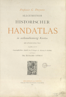
Pobierz wszystkieTytuł: Professor G. Droysens allgemeiner historischer Handatlas : in sechsundneuzig Karten mit erläuterndem Text ; Allgemeiner Historischer Handatlas ; G. Droysens Historischer Handatlas ; Historischer Handatlas
Twórca:
Droysen, Gustav (1838–1908) ; Andree, Richard (1835–1912) : Red. ; Geographische Anstalt von Velhagen und Klasing (Lipsk)
Data wydania/powstania:
Typ zasobu:
Wydawca:
Miejsce wydania:
Opis:
Skale różne ; 1 atlas ([1] k., [2], 88 s., 92 s.) : litogr., mapy kolor. ; 43 cm
Szczegółowy typ zasobu:
Format:
Identyfikator zasobu:
Źródło:
CBGiOŚ. IGiPZ PAN, sygn. B.1417 ; CBGiOŚ. IGiPZ PAN, sygn. B.KS.410 ; CBGiOŚ. IGiPZ PAN, sygn. B.KS.421 ; kliknij tutaj, żeby przejść
Język:
Prawa:
Zasady wykorzystania:
Digitalizacja:
Instytut Geografii i Przestrzennego Zagospodarowania Polskiej Akademii Nauk
Lokalizacja oryginału:
Dofinansowane ze środków:
Dostęp:
Kolekcje, do których przypisany jest obiekt:
- Instytut Geografii i Przestrzennego Zagospodarowania PAN > Biblioteka Instytutu
- Instytut Geografii i Przestrzennego Zagospodarowania PAN > Biblioteka Instytutu > Mapy i atlasy
- Instytut Geografii i Przestrzennego Zagospodarowania PAN > Biblioteka Instytutu > Wybrane księgozbiory > Księgozbiór Prof. Józefa Staszewskiego
Data ostatniej modyfikacji:
28 gru 2020
Data dodania obiektu:
28 gru 2020
Liczba pobrań / odtworzeń:
705
Wszystkie dostępne wersje tego obiektu:
https://www.rcin.org.pl/igipz/publication/17443
Wyświetl opis w formacie RDF:
Wyświetl opis w formacie RDFa:
Wyświetl opis w formacie OAI-PMH:
| Nazwa wydania | Data |
|---|---|
| Droysen, Gustav (1838-1908), 1886, Allgemeiner historischer Handatlas | 28 gru 2020 |
Obiekty Podobne
Andree, Richard (1835–1912) Geographische Anstalt von Velhagen und Klasing (Lipsk)
Andree, Richard (1835–1912) Geographische Anstalt von Velhagen und Klasing (Lipsk)
Andree, Richard (1835–1912) Scobel, Albert (1851–1912) Geographische Anstalt von Velhagen und Klasing (Lipsk)
Andree, Richard (1835–1912)
Andree, Richard (1835–1912) Putzger, Friedrich Wilhelm (1849– )
Andree, Richard (1835–1912) Peschel, Oscar (1825–1875)
Selves, Henri (17..-18..). Rys.