Object
Available formats:
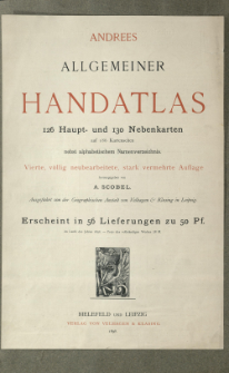
Download allTitle: Andrees allgemeiner Handatlas in 126 Haupt- und 137 Nebenkarten : nebst vollständigem alphabetischem Namenverzeichnis
Creator:
Andree, Richard (1835–1912) ; Scobel, Albert (1851–1912) : Red. ; Geographische Anstalt von Velhagen und Klasing (Lipsk)
Date issued/created:
Resource type:
Publisher:
Place of publishing:
Description:
4., völlig neubearb. und verm. Aufl. ; Scales differ ; 1 atlas ([4] p., 186 l., 179 p.) : lithogr., maps col. ; 45x30 cm ; Loose-leaves folded in container. Date on added title page and index: 1898 r. Without maps no 63-64 and 111-112 ; Index
Detailed Resource Type:
Format:
Resource Identifier:
Source:
CBGiOŚ. IGiPZ PAN, call no. B.1680 ; click here to follow the link
Language:
Rights:
Terms of use:
Digitizing institution:
Institute of Geography and Spatial Organization of the Polish Academy of Sciences
Original in:
Projects co-financed by:
Programme Innovative Economy, 2010-2014, Priority Axis 2. R&D infrastructure ; European Union. European Regional Development Fund
Access:
Object collections:
- Institute of Geography and Spatial Organization PAS (IGiPZ PAN) > Library
- Institute of Geography and Spatial Organization PAS (IGiPZ PAN) > Library > Maps and atlases
Last modified:
Jan 8, 2021
In our library since:
Jan 8, 2021
Number of object content downloads / hits:
237
All available object's versions:
https://www.rcin.org.pl/igipz/publication/19044
Show description in RDF format:
Show description in RDFa format:
Show description in OAI-PMH format:
| Edition name | Date |
|---|---|
| Andree, Richard (1835-1912), 1899, Andrees allgemeiner Handatlas in 126 Haupt- und 137 Nebenkarten | Jan 8, 2021 |
Objects Similar
Andree, Richard (1835–1912) Geographische Anstalt von Velhagen und Klasing (Lipsk)
Andree, Richard (1835–1912) Geographische Anstalt von Velhagen und Klasing (Lipsk)
Droysen, Gustav (1838–1908) Andree, Richard (1835–1912) Geographische Anstalt von Velhagen und Klasing (Lipsk)
Andree, Richard (1835–1912)
Andree, Richard (1835–1912) Putzger, Friedrich Wilhelm (1849– )
Andree, Richard (1835–1912) Peschel, Oscar (1825–1875)
Andree, Richard (1835–1912) Scobel, Albert (1851–1912)
Andree, Richard (1835–1912) Scobel, Albert (1851–1912)

 INSTYTUT ARCHEOLOGII I ETNOLOGII POLSKIEJ AKADEMII NAUK
 INSTYTUT BADAŃ LITERACKICH POLSKIEJ AKADEMII NAUK
 INSTYTUT BADAWCZY LEŚNICTWA
 INSTYTUT BIOLOGII DOŚWIADCZALNEJ IM. MARCELEGO NENCKIEGO POLSKIEJ AKADEMII NAUK
 INSTYTUT BIOLOGII SSAKÓW POLSKIEJ AKADEMII NAUK
 INSTYTUT CHEMII FIZYCZNEJ PAN
 INSTYTUT CHEMII ORGANICZNEJ PAN
 INSTYTUT FILOZOFII I SOCJOLOGII PAN
 INSTYTUT GEOGRAFII I PRZESTRZENNEGO ZAGOSPODAROWANIA PAN
 INSTYTUT HISTORII im. TADEUSZA MANTEUFFLA POLSKIEJ AKADEMII NAUK
 INSTYTUT JĘZYKA POLSKIEGO POLSKIEJ AKADEMII NAUK
 INSTYTUT MATEMATYCZNY PAN
 INSTYTUT MEDYCYNY DOŚWIADCZALNEJ I KLINICZNEJ IM.MIROSŁAWA MOSSAKOWSKIEGO POLSKIEJ AKADEMII NAUK
 INSTYTUT PODSTAWOWYCH PROBLEMÓW TECHNIKI PAN
 INSTYTUT SLAWISTYKI PAN
 SIEĆ BADAWCZA ŁUKASIEWICZ - INSTYTUT TECHNOLOGII MATERIAŁÓW ELEKTRONICZNYCH
 MUZEUM I INSTYTUT ZOOLOGII POLSKIEJ AKADEMII NAUK
 INSTYTUT BADAŃ SYSTEMOWYCH PAN
 INSTYTUT BOTANIKI IM. WŁADYSŁAWA SZAFERA POLSKIEJ AKADEMII NAUK


