- About project
- Collections
- Indexes
- Recently viewed
-
RCIN Repositories
-
 INSTYTUT ARCHEOLOGII I ETNOLOGII POLSKIEJ AKADEMII NAUK
-
 INSTYTUT BADAŃ LITERACKICH POLSKIEJ AKADEMII NAUK
-
 INSTYTUT BADAWCZY LEŚNICTWA
-
 INSTYTUT BIOLOGII DOŚWIADCZALNEJ IM. MARCELEGO NENCKIEGO POLSKIEJ AKADEMII NAUK
-
 INSTYTUT BIOLOGII SSAKÓW POLSKIEJ AKADEMII NAUK
-
 INSTYTUT CHEMII FIZYCZNEJ PAN
-
 INSTYTUT CHEMII ORGANICZNEJ PAN
-
 INSTYTUT FILOZOFII I SOCJOLOGII PAN
-
 INSTYTUT GEOGRAFII I PRZESTRZENNEGO ZAGOSPODAROWANIA PAN
-
 INSTYTUT HISTORII im. TADEUSZA MANTEUFFLA POLSKIEJ AKADEMII NAUK
-
 INSTYTUT JĘZYKA POLSKIEGO POLSKIEJ AKADEMII NAUK
-
 INSTYTUT MATEMATYCZNY PAN
-
 INSTYTUT MEDYCYNY DOŚWIADCZALNEJ I KLINICZNEJ IM.MIROSŁAWA MOSSAKOWSKIEGO POLSKIEJ AKADEMII NAUK
-
 INSTYTUT PODSTAWOWYCH PROBLEMÓW TECHNIKI PAN
-
 INSTYTUT SLAWISTYKI PAN
-
 SIEĆ BADAWCZA ŁUKASIEWICZ - INSTYTUT TECHNOLOGII MATERIAŁÓW ELEKTRONICZNYCH
-
 MUZEUM I INSTYTUT ZOOLOGII POLSKIEJ AKADEMII NAUK
-
 INSTYTUT BADAŃ SYSTEMOWYCH PAN
-
 INSTYTUT BOTANIKI IM. WŁADYSŁAWA SZAFERA POLSKIEJ AKADEMII NAUK
-

Object
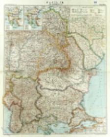
Title: Rumänien und Nachbargebieten
Subtitle:
Flemmings Kriegskarte ; Nr. 32
Contributor:
Kettler, Julius Iwan (1852–1921) : Red. ; Bludau, Alois (1861–1913) : Oprac. ; Herkt, Otto ; Carl Flemming und C. T. Wiskott Aktiengesellschaft für Verlag und Kunstdruck (Głogów)
Publisher:
Place of publishing:
Description:
Scale 1:1 500 000 ; 1 map : lithogr., col. ; 82x66 cm, sheet 88x71 cm ; Date of puiblication based on political borders: Transylvania in borders of Austro-Hungarian Empire ; Ancillary maps: Die Balkanländer im Jahre 1912, Die Balkanländer im Jahre 1914
Relation:
Detailed Resource Type:
Format:
File size 13,2 MB ; image/x.djvu
Resource Identifier:
Source:
CBGiOŚ. IGiPZ PAN, call no. D.5576 [T.9/21] ; click here to follow the link
Language:
Rights:
Terms of use:
Digitizing institution:
Institute of Geography and Spatial Organization of the Polish Academy of Sciences
Original in:
Projects co-financed by:
Programme Innovative Economy, 2010-2014, Priority Axis 2. R&D infrastructure ; European Union. European Regional Development Fund
Access:
Object collections:
- Institute of Geography and Spatial Organization PAS (IGiPZ PAN) > Library
- Institute of Geography and Spatial Organization PAS (IGiPZ PAN) > Library > Maps and atlases
Last modified:
Oct 2, 2020
In our library since:
Sep 29, 2016
Number of object content downloads / hits:
267
All available object's versions:
https://www.rcin.org.pl/igipz/publication/51143
Show description in RDF format:
Show description in RDFa format:
Show description in OAI-PMH format:
| Edition name | Date |
|---|---|
| Kettler, Julius Iwan (1852-1921). Red., [ca 1914], Rumänien und Nachbargebieten | Oct 2, 2020 |
Objects Similar
Peucker, Karl (1859–1940)
Kartographische Anstalt G. Freytag & Berndt. Wydawca. Drukarz
Stany Zjednoczone. Army Map Service. Redaktor. Wydawca Stany Zjednoczone. Army. Office of the Chief Engineers. Redaktor
Kettler, Julius Iwan (1852–1921) Bludau, Alois (1861–1913) Herkt, Otto (1885–1925) Hoch, C. Melching, Oswald