- About project
- Collections
- Indexes
- Recently viewed
-
RCIN Repositories
-
 INSTYTUT ARCHEOLOGII I ETNOLOGII POLSKIEJ AKADEMII NAUK
-
 INSTYTUT BADAŃ LITERACKICH POLSKIEJ AKADEMII NAUK
-
 INSTYTUT BADAWCZY LEŚNICTWA
-
 INSTYTUT BIOLOGII DOŚWIADCZALNEJ IM. MARCELEGO NENCKIEGO POLSKIEJ AKADEMII NAUK
-
 INSTYTUT BIOLOGII SSAKÓW POLSKIEJ AKADEMII NAUK
-
 INSTYTUT CHEMII FIZYCZNEJ PAN
-
 INSTYTUT CHEMII ORGANICZNEJ PAN
-
 INSTYTUT FILOZOFII I SOCJOLOGII PAN
-
 INSTYTUT GEOGRAFII I PRZESTRZENNEGO ZAGOSPODAROWANIA PAN
-
 INSTYTUT HISTORII im. TADEUSZA MANTEUFFLA POLSKIEJ AKADEMII NAUK
-
 INSTYTUT JĘZYKA POLSKIEGO POLSKIEJ AKADEMII NAUK
-
 INSTYTUT MATEMATYCZNY PAN
-
 INSTYTUT MEDYCYNY DOŚWIADCZALNEJ I KLINICZNEJ IM.MIROSŁAWA MOSSAKOWSKIEGO POLSKIEJ AKADEMII NAUK
-
 INSTYTUT PODSTAWOWYCH PROBLEMÓW TECHNIKI PAN
-
 INSTYTUT SLAWISTYKI PAN
-
 SIEĆ BADAWCZA ŁUKASIEWICZ - INSTYTUT TECHNOLOGII MATERIAŁÓW ELEKTRONICZNYCH
-
 MUZEUM I INSTYTUT ZOOLOGII POLSKIEJ AKADEMII NAUK
-
 INSTYTUT BADAŃ SYSTEMOWYCH PAN
-
 INSTYTUT BOTANIKI IM. WŁADYSŁAWA SZAFERA POLSKIEJ AKADEMII NAUK
-

Object
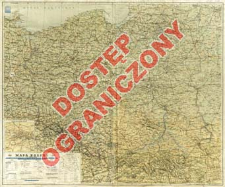
Title: Mapa Polski : 1:1 000 000
Contributor:
Wojskowy Instytut Geograficzny
Publisher:
Wojskowy Instytut Geograficzny Sztab Generalny
Place of publishing:
Description:
Wyd. tymczasowe. ; Skala 1:1 000 000 ; odwzorowanie stożkowe Albersa ; 1 mapa : kolor. ; 68x83 cm ; Mapy poboczne: Górnośląskie Zagłębie Węglowe. - Skala [ca 1:550 000] ; Województwa : stan na dzień 1. XII.1945 ; Adnot. na mapie: Nieprzemianowane nazwy niemieckie na terenach odzyskanych ujęte są w nawiasy jako tymczasowe ; Nazwy geogr. w jęz. pol., część również w jęz. niem.
Detailed Resource Type:
Format:
Resource Identifier:
Source:
CBGiOŚ. IGiPZ PAN, sygn. D.5399 [m.ogólnog.89] ; click here to follow the link
Language:
Rights:
Prawa zastrzeżone - dostęp ograniczony
Terms of use:
Digitizing institution:
Instytut Geografii i Przestrzennego Zagospodarowania Polskiej Akademii Nauk
Original in:
Projects co-financed by:
Program Operacyjny Innowacyjna Gospodarka, lata 2010-2014, Priorytet 2. Infrastruktura strefy B + R ; Unia Europejska. Europejski Fundusz Rozwoju Regionalnego
Access:
Object collections:
- Institute of Geography and Spatial Organization PAS (IGiPZ PAN) > Library
- Institute of Geography and Spatial Organization PAS (IGiPZ PAN) > Library > Maps and atlases
Last modified:
Oct 2, 2020
In our library since:
Jun 28, 2013
Number of object content downloads / hits:
26
All available object's versions:
https://www.rcin.org.pl/igipz/publication/43869
Show description in RDF format:
Show description in RDFa format:
Show description in OAI-PMH format:
| Edition name | Date |
|---|---|
| Mapa Polski : 1:1 000 000, 1945 | Oct 2, 2020 |
Objects Similar
Romer, Eugeniusz (1871–1954) Migacz, Władysław Instytut Kartograficzny im. Eugeniusza Romera Książnica-Atlas, Zjednoczone Zakłady Kartograficzne i Wydawnicze Towarzystwa Nauczycieli Szkół Średnich i Wyższych
Krygowski, Bogumił (1905–1977) Drukarnia i Księgarnia Św. Wojciecha


