Object
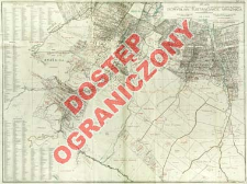
Title: Plan kopalń i pól naftowych, gmin Borysław, Tustanowice, Mrażnica = Plan der Naphtag-gruben und -felder der Gemeinden Borysław, Tustanowice, Mrażnica
Subtitle:
Plan der Naphta-gruben und -felder der Gemeinden Borysław, Tustanowice, Mrażnica ; Plan der Naphtagruben und -felder der Gemeinden Borysław, Tustanowice, Mrażnica
Contributor:
Publisher:
F. Ewig ; (drukiem Instytut Wojskowogeograficznego)
Place of publishing:
Description:
Scale 1:7 500 ; 1 map : col. ; 82x111cm, on sheet 85x 115 cm, folded in cover 22x15 cm ; Map title ; Indeox of mines and oil wells ; Title in Polish and German, geographical names in Polish
Detailed Resource Type:
Format:
Resource Identifier:
Source:
CBGiOŚ. IGiPZ PAN, call no. D.16236 [m.gosp.14] ; click here to follow the link
Language:
Rights:
Rights Reserved - Restricted Access
Terms of use:
Digitizing institution:
Institute of Geography and Spatial Organization of the Polish Academy of Sciences
Original in:
Projects co-financed by:
Programme Innovative Economy, 2010-2014, Priority Axis 2. R&D infrastructure ; European Union. European Regional Development Fund
Access:
Object collections:
- Institute of Geography and Spatial Organization PAS (IGiPZ PAN) > Library
- Institute of Geography and Spatial Organization PAS (IGiPZ PAN) > Library > Maps and atlases
Last modified:
Oct 2, 2020
In our library since:
Jun 11, 2013
Number of object content downloads / hits:
119
All available object's versions:
https://www.rcin.org.pl/igipz/publication/41382
Show description in RDF format:
Show description in RDFa format:
Show description in OAI-PMH format:
| Edition name | Date |
|---|---|
| Ewig, F. Oprac., 1920, Plan kopalń i pól naftowych, gmin Borysław, Tustanowice, Mrażnica | Oct 2, 2020 |
Objects Similar
Tołwiński, Konstanty (1877–1961)
Tołwiński, Konstanty (1877–1961)
Bujalski, Bolesław (1888–1945) Wojskowy Instytut Geograficzny (Warszawa). Wydawca Państwowy Instytut Geologiczny. Instytucja sprawcza
Tołwiński, Konstanty (1877–1961) Krajewski, Stanisław (1890–1968) Wojskowy Instytut Geograficzny (Warszawa). Instytucja sprawcza. Wydawca Państwowy Instytut Geologiczny. Instytucja sprawcza
Schmidt, Antoni Górniczy Komitet Redakcyjny

 INSTYTUT ARCHEOLOGII I ETNOLOGII POLSKIEJ AKADEMII NAUK
 INSTYTUT BADAŃ LITERACKICH POLSKIEJ AKADEMII NAUK
 INSTYTUT BADAWCZY LEŚNICTWA
 INSTYTUT BIOLOGII DOŚWIADCZALNEJ IM. MARCELEGO NENCKIEGO POLSKIEJ AKADEMII NAUK
 INSTYTUT BIOLOGII SSAKÓW POLSKIEJ AKADEMII NAUK
 INSTYTUT CHEMII FIZYCZNEJ PAN
 INSTYTUT CHEMII ORGANICZNEJ PAN
 INSTYTUT FILOZOFII I SOCJOLOGII PAN
 INSTYTUT GEOGRAFII I PRZESTRZENNEGO ZAGOSPODAROWANIA PAN
 INSTYTUT HISTORII im. TADEUSZA MANTEUFFLA POLSKIEJ AKADEMII NAUK
 INSTYTUT JĘZYKA POLSKIEGO POLSKIEJ AKADEMII NAUK
 INSTYTUT MATEMATYCZNY PAN
 INSTYTUT MEDYCYNY DOŚWIADCZALNEJ I KLINICZNEJ IM.MIROSŁAWA MOSSAKOWSKIEGO POLSKIEJ AKADEMII NAUK
 INSTYTUT PODSTAWOWYCH PROBLEMÓW TECHNIKI PAN
 INSTYTUT SLAWISTYKI PAN
 SIEĆ BADAWCZA ŁUKASIEWICZ - INSTYTUT TECHNOLOGII MATERIAŁÓW ELEKTRONICZNYCH
 MUZEUM I INSTYTUT ZOOLOGII POLSKIEJ AKADEMII NAUK
 INSTYTUT BADAŃ SYSTEMOWYCH PAN
 INSTYTUT BOTANIKI IM. WŁADYSŁAWA SZAFERA POLSKIEJ AKADEMII NAUK


