Object
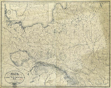
Title: Mapa hydrograficzna dawnej słowiańszczyzny : część zachodnio-pólnocna
Publisher:
Place of publishing:
Description:
Scale 1:2 000 000, 15 mil geogr.= 1ʿ R ; 1 map : lithogr. ; 62x81 cm ; Dozvoleno cenzuroû. Varšava 18 fev. 1882 goda oraz Willner freres à Teplitz, Boheme ; Accompanied by: Rzeki i jeziora : tekst objaśniający do mapy hydrograficznéj dawnéj Słowiańszczyzny części północno zachodniéj / przez W. K. - Warszawa, 1883 ; Cited in: Estr. XIX, Wyd. 2, T. 17, p. 430
Detailed Resource Type:
Format:
File size 4,5 MB ; image/x.djvu
Resource Identifier:
Source:
CBGiOŚ. IGiPZ PAN, call no. D.1904 [I.3A-10] ; CBGiOŚ. IGiPZ PAN, call no. Ds.8372 [I.3A-12] ; click here to follow the link
Language:
Rights:
Terms of use:
Digitizing institution:
Institute of Geography and Spatial Organization of the Polish Academy of Sciences
Original in:
Projects co-financed by:
Programme Innovative Economy, 2010-2014, Priority Axis 2. R&D infrastructure ; European Union. European Regional Development Fund
Access:
Object collections:
- Institute of Geography and Spatial Organization PAS (IGiPZ PAN) > Library
- Institute of Geography and Spatial Organization PAS (IGiPZ PAN) > Library > Maps and atlases
Last modified:
Oct 2, 2020
In our library since:
Aug 22, 2011
Number of object content downloads / hits:
479
All available object's versions:
https://www.rcin.org.pl/igipz/publication/2048
Show description in RDF format:
Show description in RDFa format:
Show description in OAI-PMH format:
| Edition name | Date |
|---|---|
| Mapa hydrograficzna dawnej słowiańszczyzny ; część zachodnio-północna / Walery Kopernicki | Oct 2, 2020 |
Objects Similar
Kopernicki, Walery (1819–1895)
Wüllerstorf-Urbair, Bernard von (1816–1883)
Wüllerstorf-Urbair, Bernard von (1816–1883)

 INSTYTUT ARCHEOLOGII I ETNOLOGII POLSKIEJ AKADEMII NAUK
 INSTYTUT BADAŃ LITERACKICH POLSKIEJ AKADEMII NAUK
 INSTYTUT BADAWCZY LEŚNICTWA
 INSTYTUT BIOLOGII DOŚWIADCZALNEJ IM. MARCELEGO NENCKIEGO POLSKIEJ AKADEMII NAUK
 INSTYTUT BIOLOGII SSAKÓW POLSKIEJ AKADEMII NAUK
 INSTYTUT CHEMII FIZYCZNEJ PAN
 INSTYTUT CHEMII ORGANICZNEJ PAN
 INSTYTUT FILOZOFII I SOCJOLOGII PAN
 INSTYTUT GEOGRAFII I PRZESTRZENNEGO ZAGOSPODAROWANIA PAN
 INSTYTUT HISTORII im. TADEUSZA MANTEUFFLA POLSKIEJ AKADEMII NAUK
 INSTYTUT JĘZYKA POLSKIEGO POLSKIEJ AKADEMII NAUK
 INSTYTUT MATEMATYCZNY PAN
 INSTYTUT MEDYCYNY DOŚWIADCZALNEJ I KLINICZNEJ IM.MIROSŁAWA MOSSAKOWSKIEGO POLSKIEJ AKADEMII NAUK
 INSTYTUT PODSTAWOWYCH PROBLEMÓW TECHNIKI PAN
 INSTYTUT SLAWISTYKI PAN
 SIEĆ BADAWCZA ŁUKASIEWICZ - INSTYTUT TECHNOLOGII MATERIAŁÓW ELEKTRONICZNYCH
 MUZEUM I INSTYTUT ZOOLOGII POLSKIEJ AKADEMII NAUK
 INSTYTUT BADAŃ SYSTEMOWYCH PAN
 INSTYTUT BOTANIKI IM. WŁADYSŁAWA SZAFERA POLSKIEJ AKADEMII NAUK


