- About project
- Collections
- Indexes
- Recently viewed
-
RCIN Repositories
-
 INSTYTUT ARCHEOLOGII I ETNOLOGII POLSKIEJ AKADEMII NAUK
-
 INSTYTUT BADAŃ LITERACKICH POLSKIEJ AKADEMII NAUK
-
 INSTYTUT BADAWCZY LEŚNICTWA
-
 INSTYTUT BIOLOGII DOŚWIADCZALNEJ IM. MARCELEGO NENCKIEGO POLSKIEJ AKADEMII NAUK
-
 INSTYTUT BIOLOGII SSAKÓW POLSKIEJ AKADEMII NAUK
-
 INSTYTUT CHEMII FIZYCZNEJ PAN
-
 INSTYTUT CHEMII ORGANICZNEJ PAN
-
 INSTYTUT FILOZOFII I SOCJOLOGII PAN
-
 INSTYTUT GEOGRAFII I PRZESTRZENNEGO ZAGOSPODAROWANIA PAN
-
 INSTYTUT HISTORII im. TADEUSZA MANTEUFFLA POLSKIEJ AKADEMII NAUK
-
 INSTYTUT JĘZYKA POLSKIEGO POLSKIEJ AKADEMII NAUK
-
 INSTYTUT MATEMATYCZNY PAN
-
 INSTYTUT MEDYCYNY DOŚWIADCZALNEJ I KLINICZNEJ IM.MIROSŁAWA MOSSAKOWSKIEGO POLSKIEJ AKADEMII NAUK
-
 INSTYTUT PODSTAWOWYCH PROBLEMÓW TECHNIKI PAN
-
 INSTYTUT SLAWISTYKI PAN
-
 SIEĆ BADAWCZA ŁUKASIEWICZ - INSTYTUT TECHNOLOGII MATERIAŁÓW ELEKTRONICZNYCH
-
 MUZEUM I INSTYTUT ZOOLOGII POLSKIEJ AKADEMII NAUK
-
 INSTYTUT BADAŃ SYSTEMOWYCH PAN
-
 INSTYTUT BOTANIKI IM. WŁADYSŁAWA SZAFERA POLSKIEJ AKADEMII NAUK
-

Object
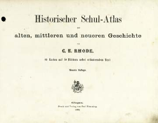
Title: Historischer Schul-Atlas zur alten, mittleren und neueren Geschichte : 89 Karten auf 30 Blättern nebst erläutendem Text ; Rhode's historischer Schul-Atlas
Publisher:
Druck und Verlag von Carl Flemming
Place of publishing:
Description:
9. Aufl. ; Scales differ ; 1 atlas ([1], 28 l., 30 p.) : lithogr., maps col. ; 24x30 cm ; Subtitle error: not 89 maps on 30 leaves but 84 maps on 28 leaves
Detailed Resource Type:
Format:
Resource Identifier:
Source:
CBGiOŚ. IGiPZ PAN, call no. B.KS.244 ; click here to follow the link
Language:
Rights:
Terms of use:
Digitizing institution:
Institute of Geography and Spatial Organization of the Polish Academy of Sciences
Original in:
Projects co-financed by:
Programme Innovative Economy, 2010-2014, Priority Axis 2. R&D infrastructure ; European Union. European Regional Development Fund
Access:
Object collections:
- Institute of Geography and Spatial Organization PAS (IGiPZ PAN) > Library
- Institute of Geography and Spatial Organization PAS (IGiPZ PAN) > Library > Maps and atlases
- Institute of Geography and Spatial Organization PAS (IGiPZ PAN) > Library > Selected collections > Prof. Józef Staszewski Collection
Last modified:
Oct 2, 2020
In our library since:
Feb 19, 2013
Number of object content downloads / hits:
440
All available object's versions:
https://www.rcin.org.pl/igipz/publication/14229
Show description in RDF format:
Show description in RDFa format:
Show description in OAI-PMH format:
Objects Similar
Rhode, C. E.
Rhode, C. E. Flemming, Carl (1806–1878)
Schade, Theodor ( –1882) Flemming, Carl (1806–1878)
Spruner, Karl von (1803–1892)
Putzger, Friedrich Wilhelm (1849–1913)
Spruner, Karl von (1803–1892) Menke, Theodor (1819–1892) Justus Perthes (Gotha)
Sohr, Karl Flemming, Carl (1806–1878) Handtke, Friedrich H. (1815–1879) Berghaus, Heinrich Karl Wilhelm (1797–1884)


