- O repozytorium
- Kolekcje
- Indeksy
- Historia przeglądania
-
Repozytoria RCIN
-
 INSTYTUT ARCHEOLOGII I ETNOLOGII POLSKIEJ AKADEMII NAUK
-
 INSTYTUT BADAŃ LITERACKICH POLSKIEJ AKADEMII NAUK
-
 INSTYTUT BADAWCZY LEŚNICTWA
-
 INSTYTUT BIOLOGII DOŚWIADCZALNEJ IM. MARCELEGO NENCKIEGO POLSKIEJ AKADEMII NAUK
-
 INSTYTUT BIOLOGII SSAKÓW POLSKIEJ AKADEMII NAUK
-
 INSTYTUT CHEMII FIZYCZNEJ PAN
-
 INSTYTUT CHEMII ORGANICZNEJ PAN
-
 INSTYTUT FILOZOFII I SOCJOLOGII PAN
-
 INSTYTUT GEOGRAFII I PRZESTRZENNEGO ZAGOSPODAROWANIA PAN
-
 INSTYTUT HISTORII im. TADEUSZA MANTEUFFLA POLSKIEJ AKADEMII NAUK
-
 INSTYTUT JĘZYKA POLSKIEGO POLSKIEJ AKADEMII NAUK
-
 INSTYTUT MATEMATYCZNY PAN
-
 INSTYTUT MEDYCYNY DOŚWIADCZALNEJ I KLINICZNEJ IM.MIROSŁAWA MOSSAKOWSKIEGO POLSKIEJ AKADEMII NAUK
-
 INSTYTUT PODSTAWOWYCH PROBLEMÓW TECHNIKI PAN
-
 INSTYTUT SLAWISTYKI PAN
-
 SIEĆ BADAWCZA ŁUKASIEWICZ - INSTYTUT TECHNOLOGII MATERIAŁÓW ELEKTRONICZNYCH
-
 MUZEUM I INSTYTUT ZOOLOGII POLSKIEJ AKADEMII NAUK
-
 INSTYTUT BADAŃ SYSTEMOWYCH PAN
-
 INSTYTUT BOTANIKI IM. WŁADYSŁAWA SZAFERA POLSKIEJ AKADEMII NAUK
-

Obiekt
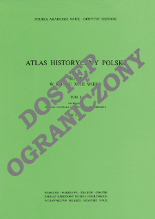
Tytuł: Śląsk w końcu XVIII wieku ; 1, cz. 1, Mapy
Inny tytuł:
Atlas historyczny Polski - Polska Akademia Nauk. Instytut Historii. Mapy XVIII wieku ; 1 cz.1
Współtwórca:
Janczak, Julian (1932–1995) : Red. ; Ładogórski, Tadeusz (1905–1995) : Red. ; Institute of History of the Polish Academy of Sciences
Wydawca:
Zakład Narodowy im. Ossolińskich - Wydawawnictwo Polskiej Akademii Nauk
Miejsce wydania:
Opis:
Description from the cover ; complements the text published in Atlas Historyczny Polski. Polska Akademia Nauk. Instytut Historii. Mapy XVIII wieku ; 1 ; contens maps: administrative division and the geographical environment in Silesia in the 18th c. ; population density in Silesia in the 18th c. ; ethnical relations in Silesia in the 18th c. ; the distribution of religious denominations in Silesia in the 18th c. ; towns and the social structure of villages in Silesia in the 18th c. ; feudal property (in accordance with orders) in Silesia in the 18th c, ; feudal property (according to size) in Silesia in the 18th c. ; agriculture in Silesia in the 18th c. ; 8 maps col. jointly folded in cover 30x20 cm ; Scales differ ; List of maps pol., eng., rus., ger.
Czasopismo/Seria/cykl:
Atlas historyczny Polski - Polska Akademia Nauk. Instytut Historii. Mapy XVIII wieku ; 1, cz. 1
Szczegółowy typ zasobu:
Format:
Identyfikator zasobu:
Źródło:
IH PAN, sygn. III.847/1, cz.1 Podr. ; IH PAN, sygn. III.848/1, cz.1 ; kliknij tutaj, żeby przejść
Język:
Prawa:
Rights Reserved - Restricted Access
Zasady wykorzystania:
Digitalizacja:
Institute of History of the Polish Academy of Sciences
Lokalizacja oryginału:
Library of the Institute of History PAS
Dofinansowane ze środków:
Programme Innovative Economy, 2010-2014, Priority Axis 2. R&D infrastructure ; European Union. European Regional Development Fund
Dostęp:
Kolekcje, do których przypisany jest obiekt:
- Instytut Historii PAN > Atlasy historyczne
- Instytut Historii PAN > Wydawnictwa Instytutu
- Instytut Historii PAN > Wydawnictwa Instytutu > Książki
Data ostatniej modyfikacji:
2 paź 2020
Data dodania obiektu:
30 maj 2012
Liczba pobrań / odtworzeń:
561
Wszystkie dostępne wersje tego obiektu:
https://www.rcin.org.pl/ihpan/publication/6821
Wyświetl opis w formacie RDF:
Wyświetl opis w formacie RDFa:
Wyświetl opis w formacie OAI-PMH:
| Nazwa wydania | Data |
|---|---|
| Śląsk w końcu XVIII wieku ; 1, cz. 1, Mapy | 2 paź 2020 |


