- About project
- Collections
- Indexes
- Recently viewed
-
RCIN Repositories
-
 INSTYTUT ARCHEOLOGII I ETNOLOGII POLSKIEJ AKADEMII NAUK
-
 INSTYTUT BADAŃ LITERACKICH POLSKIEJ AKADEMII NAUK
-
 INSTYTUT BADAWCZY LEŚNICTWA
-
 INSTYTUT BIOLOGII DOŚWIADCZALNEJ IM. MARCELEGO NENCKIEGO POLSKIEJ AKADEMII NAUK
-
 INSTYTUT BIOLOGII SSAKÓW POLSKIEJ AKADEMII NAUK
-
 INSTYTUT CHEMII FIZYCZNEJ PAN
-
 INSTYTUT CHEMII ORGANICZNEJ PAN
-
 INSTYTUT FILOZOFII I SOCJOLOGII PAN
-
 INSTYTUT GEOGRAFII I PRZESTRZENNEGO ZAGOSPODAROWANIA PAN
-
 INSTYTUT HISTORII im. TADEUSZA MANTEUFFLA POLSKIEJ AKADEMII NAUK
-
 INSTYTUT JĘZYKA POLSKIEGO POLSKIEJ AKADEMII NAUK
-
 INSTYTUT MATEMATYCZNY PAN
-
 INSTYTUT MEDYCYNY DOŚWIADCZALNEJ I KLINICZNEJ IM.MIROSŁAWA MOSSAKOWSKIEGO POLSKIEJ AKADEMII NAUK
-
 INSTYTUT PODSTAWOWYCH PROBLEMÓW TECHNIKI PAN
-
 INSTYTUT SLAWISTYKI PAN
-
 SIEĆ BADAWCZA ŁUKASIEWICZ - INSTYTUT TECHNOLOGII MATERIAŁÓW ELEKTRONICZNYCH
-
 MUZEUM I INSTYTUT ZOOLOGII POLSKIEJ AKADEMII NAUK
-
 INSTYTUT BADAŃ SYSTEMOWYCH PAN
-
 INSTYTUT BOTANIKI IM. WŁADYSŁAWA SZAFERA POLSKIEJ AKADEMII NAUK
-

Object
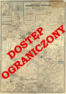
Title: Mapa informacyjna rozmieszczenia przemysłu w Polsce : wedle zatrudnionych robotników a obejmująca zakłady przemysłowe od 20 robotników
Subtitle:
Contributor:
Publisher:
Specjalne wydawnictwo map S. Korytko ; (Zakł. Graf. S.A. Książnica-Atlas)
Place of publishing:
Description:
Skala 1:1 200 000 ; 1 mapa : kolor ; 99x70 cm, po złoż. w okł. 26x21 cm ; Mapy poboczne : Port Gdańsk 1:45 000 ; Port Gdynia 1:45 000 ; Rozwój portów Gdańsk Gdynia (wykres) ; Okręg przemysłowy Katowice, Kraków, Kielce 1:600 000 ; Statystyczna mapa zatrudnienia przy produkcji przemysłowej ułożona wedle województw i działów przemysłu ; Przemysł naftowy : okręg Drohobycz 1:120 000 ; Ogólna statystyka zatrudnienia ; BNPol online ; Cyt. w: Polski Przegląd Kartograficzny. Nr 41. - Lwów ; Warszawa, 1933. poz. 788, s. 97
Detailed Resource Type:
Format:
Resource Identifier:
Source:
CBGiOŚ. IGiPZ PAN, call no. D.6041 [m.gospod.1] ; click here to follow the link
Language:
Rights:
Rights Reserved - Restricted Access
Terms of use:
Digitizing institution:
Institute of Geography and Spatial Organization of the Polish Academy of Sciences
Original in:
Projects co-financed by:
Programme Innovative Economy, 2010-2014, Priority Axis 2. R&D infrastructure ; European Union. European Regional Development Fund
Access:
Object collections:
- Institute of Geography and Spatial Organization PAS (IGiPZ PAN) > Library
- Institute of Geography and Spatial Organization PAS (IGiPZ PAN) > Library > Maps and atlases
- Institute of Geography and Spatial Organization PAS (IGiPZ PAN) > Library > Selected collections > Polish Geographical Society Collection
Last modified:
Oct 2, 2020
In our library since:
Dec 1, 2015
Number of object content downloads / hits:
299
All available object's versions:
https://www.rcin.org.pl/igipz/publication/44100
Show description in RDF format:
Show description in RDFa format:
Show description in OAI-PMH format:
Objects Similar
Korytko, Stefan
Müller, Wilhelm
Korytko, Stefan Maleczyński, Karol (1897–1968) Grotowski, Zbigniew Potocki, Ignacy (1906–1994)


