Object
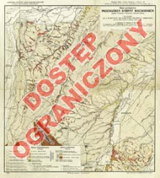
Title: Mapa geologiczna Przedgórza Karpat Wschodnich między Łomnicą a Bystrzycą Nadwórniańska = Carte géologique de l'avant-pays des Karpathes Polonaises Orientales entre les rivières Łomnika et Bystrzyca Nadwórniańska
Subtitle:
Contributor:
Wyszyński, Otto V : Oprac. ; Teisseyre, Henryk (1903–1975) : Oprac. ; Obtułowicz, Julian : Oprac. ; Karpacki Instytut Geologiczno-Naftowy ; Książnica-Atlas, Zjednoczone Zakłady Kartograficzne i Wydawnicze Towarzystwa Nauczycieli Szkół Średnich i Wyższych
Publisher:
Karpacki Instytut Geologiczno-Naftowy ; (Zakł. Graf. S.A. Książnica-Atlas)
Place of publishing:
Description:
Skala 1:750 000 ; 1 mapa : kolor. ; 44x40 cm, na ark. 53x48 cm ; Tyt. z mapy ; Rzeźba terenu przedstawiona za pomocą poziomic i punktów wysokościowych ; Mapa jest zał. do: Kopalnie Nafty i Gazów Ziemnych w Polsce, T.3 ; Tyt. i legenda w jęz.fr. i pol.
Detailed Resource Type:
Format:
Resource Identifier:
Source:
CBGiOŚ. IGiPZ PAN, call no. D.6002 [m.geol.cz.Polski.23] ; click here to follow the link
Language:
Rights:
Rights Reserved - Restricted Access
Terms of use:
Digitizing institution:
Institute of Geography and Spatial Organization of the Polish Academy of Sciences
Original in:
Projects co-financed by:
Programme Innovative Economy, 2010-2014, Priority Axis 2. R&D infrastructure ; European Union. European Regional Development Fund
Access:
Object collections:
- Institute of Geography and Spatial Organization PAS (IGiPZ PAN) > Library
- Institute of Geography and Spatial Organization PAS (IGiPZ PAN) > Library > Maps and atlases
Last modified:
Oct 2, 2020
In our library since:
Jun 11, 2013
Number of object content downloads / hits:
38
All available object's versions:
https://www.rcin.org.pl/igipz/publication/41336
Show description in RDF format:
Show description in RDFa format:
Show description in OAI-PMH format:
Objects Similar
Bujalski, Bolesław (1888–1945) Wojskowy Instytut Geograficzny (Warszawa). Wydawca Państwowy Instytut Geologiczny. Instytucja sprawcza
Tołwiński, Konstanty (1877–1961) Krajewski, Stanisław (1890–1968) Wojskowy Instytut Geograficzny (Warszawa). Instytucja sprawcza. Wydawca Państwowy Instytut Geologiczny. Instytucja sprawcza
Grzybowski, Józef (1869–1922) Morozewicz, Józef (1865–1941) Weyberg, Zygmunt (1872–1945)
Wyszyński, Otto V.

 INSTYTUT ARCHEOLOGII I ETNOLOGII POLSKIEJ AKADEMII NAUK
 INSTYTUT BADAŃ LITERACKICH POLSKIEJ AKADEMII NAUK
 INSTYTUT BADAWCZY LEŚNICTWA
 INSTYTUT BIOLOGII DOŚWIADCZALNEJ IM. MARCELEGO NENCKIEGO POLSKIEJ AKADEMII NAUK
 INSTYTUT BIOLOGII SSAKÓW POLSKIEJ AKADEMII NAUK
 INSTYTUT CHEMII FIZYCZNEJ PAN
 INSTYTUT CHEMII ORGANICZNEJ PAN
 INSTYTUT FILOZOFII I SOCJOLOGII PAN
 INSTYTUT GEOGRAFII I PRZESTRZENNEGO ZAGOSPODAROWANIA PAN
 INSTYTUT HISTORII im. TADEUSZA MANTEUFFLA POLSKIEJ AKADEMII NAUK
 INSTYTUT JĘZYKA POLSKIEGO POLSKIEJ AKADEMII NAUK
 INSTYTUT MATEMATYCZNY PAN
 INSTYTUT MEDYCYNY DOŚWIADCZALNEJ I KLINICZNEJ IM.MIROSŁAWA MOSSAKOWSKIEGO POLSKIEJ AKADEMII NAUK
 INSTYTUT PODSTAWOWYCH PROBLEMÓW TECHNIKI PAN
 INSTYTUT SLAWISTYKI PAN
 SIEĆ BADAWCZA ŁUKASIEWICZ - INSTYTUT TECHNOLOGII MATERIAŁÓW ELEKTRONICZNYCH
 MUZEUM I INSTYTUT ZOOLOGII POLSKIEJ AKADEMII NAUK
 INSTYTUT BADAŃ SYSTEMOWYCH PAN
 INSTYTUT BOTANIKI IM. WŁADYSŁAWA SZAFERA POLSKIEJ AKADEMII NAUK


