Object
Available formats:
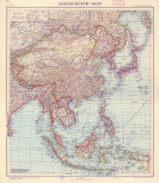
Download allTitle: Ostasiatischer - Raum : Maßstab 1:10 000 000
Institutional creator:
Niemcy. Heer. Generalstab. Abteilung für Kriegskarten und Vermessungswesen.
Publisher:
Gen St d H, Abt f Kr K u Verm W (II)
Place of publishing:
Description:
Scale 1:10 000 000 ; 1 map : color ; 81 x 70 cm, on sheet 90 x 78 cm ; Annotation on the margin: I.1942 (D 56); XI. 1940; Vergrößerung der Karte: Ostasiatische Staaten und Niederländisch-Indien 1:18 000 000 des Bibliographischen Instituts AG., Leipzig
Detailed Resource Type:
Resource Identifier:
Source:
CBGiOŚ. IGiPZ PAN, call no. D.20198 ; click here to follow the link
Language:
Coverage:
Rights:
Terms of use:
Digitizing institution:
Institute of Geography and Spatial Organization of the Polish Academy of Sciences
Original in:
Projects co-financed by:
Access:
Object collections:
Last modified:
Oct 20, 2021
In our library since:
Oct 18, 2021
Number of object content downloads / hits:
34
All available object's versions:
https://www.rcin.org.pl/igipz/publication/225425
Show description in RDF format:
Show description in RDFa format:
Show description in OAI-PMH format:
| Edition name | Date |
|---|---|
| Ostasiatischer - Raum : Maßstab 1:10 000 000, 1942 | Oct 20, 2021 |

 INSTYTUT ARCHEOLOGII I ETNOLOGII POLSKIEJ AKADEMII NAUK
 INSTYTUT BADAŃ LITERACKICH POLSKIEJ AKADEMII NAUK
 INSTYTUT BADAWCZY LEŚNICTWA
 INSTYTUT BIOLOGII DOŚWIADCZALNEJ IM. MARCELEGO NENCKIEGO POLSKIEJ AKADEMII NAUK
 INSTYTUT BIOLOGII SSAKÓW POLSKIEJ AKADEMII NAUK
 INSTYTUT CHEMII FIZYCZNEJ PAN
 INSTYTUT CHEMII ORGANICZNEJ PAN
 INSTYTUT FILOZOFII I SOCJOLOGII PAN
 INSTYTUT GEOGRAFII I PRZESTRZENNEGO ZAGOSPODAROWANIA PAN
 INSTYTUT HISTORII im. TADEUSZA MANTEUFFLA POLSKIEJ AKADEMII NAUK
 INSTYTUT JĘZYKA POLSKIEGO POLSKIEJ AKADEMII NAUK
 INSTYTUT MATEMATYCZNY PAN
 INSTYTUT MEDYCYNY DOŚWIADCZALNEJ I KLINICZNEJ IM.MIROSŁAWA MOSSAKOWSKIEGO POLSKIEJ AKADEMII NAUK
 INSTYTUT PODSTAWOWYCH PROBLEMÓW TECHNIKI PAN
 INSTYTUT SLAWISTYKI PAN
 SIEĆ BADAWCZA ŁUKASIEWICZ - INSTYTUT TECHNOLOGII MATERIAŁÓW ELEKTRONICZNYCH
 MUZEUM I INSTYTUT ZOOLOGII POLSKIEJ AKADEMII NAUK
 INSTYTUT BADAŃ SYSTEMOWYCH PAN
 INSTYTUT BOTANIKI IM. WŁADYSŁAWA SZAFERA POLSKIEJ AKADEMII NAUK


