- About project
- Collections
- Indexes
- Recently viewed
-
RCIN Repositories
-
 INSTYTUT ARCHEOLOGII I ETNOLOGII POLSKIEJ AKADEMII NAUK
-
 INSTYTUT BADAŃ LITERACKICH POLSKIEJ AKADEMII NAUK
-
 INSTYTUT BADAWCZY LEŚNICTWA
-
 INSTYTUT BIOLOGII DOŚWIADCZALNEJ IM. MARCELEGO NENCKIEGO POLSKIEJ AKADEMII NAUK
-
 INSTYTUT BIOLOGII SSAKÓW POLSKIEJ AKADEMII NAUK
-
 INSTYTUT CHEMII FIZYCZNEJ PAN
-
 INSTYTUT CHEMII ORGANICZNEJ PAN
-
 INSTYTUT FILOZOFII I SOCJOLOGII PAN
-
 INSTYTUT GEOGRAFII I PRZESTRZENNEGO ZAGOSPODAROWANIA PAN
-
 INSTYTUT HISTORII im. TADEUSZA MANTEUFFLA POLSKIEJ AKADEMII NAUK
-
 INSTYTUT JĘZYKA POLSKIEGO POLSKIEJ AKADEMII NAUK
-
 INSTYTUT MATEMATYCZNY PAN
-
 INSTYTUT MEDYCYNY DOŚWIADCZALNEJ I KLINICZNEJ IM.MIROSŁAWA MOSSAKOWSKIEGO POLSKIEJ AKADEMII NAUK
-
 INSTYTUT PODSTAWOWYCH PROBLEMÓW TECHNIKI PAN
-
 INSTYTUT SLAWISTYKI PAN
-
 SIEĆ BADAWCZA ŁUKASIEWICZ - INSTYTUT TECHNOLOGII MATERIAŁÓW ELEKTRONICZNYCH
-
 MUZEUM I INSTYTUT ZOOLOGII POLSKIEJ AKADEMII NAUK
-
 INSTYTUT BADAŃ SYSTEMOWYCH PAN
-
 INSTYTUT BOTANIKI IM. WŁADYSŁAWA SZAFERA POLSKIEJ AKADEMII NAUK
-

Object
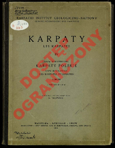
Title: Karpaty. 4, Karpaty Polskie : mapa warstwicowa : 1:300 000 = Les Karpates. 4, Les Karpates Polonaises : carte hypsométrique ; Karpaty Polskie z uwzględnieniem karpackich krajów ościennych ; Karpaty Polskie ; Karpates Polonaises ; Karpates. 4, Les Karpates Polonaises : carte hypsométrique
Creator:
Tołwiński, Konstanty (1877–1961) : Red. ; Karpacki Instytut Geologiczno-Naftowy
Date issued/created:
Resource type:
Publisher:
Skład Główny: Kasa im. Mianowskiego ; (Odbito w Zakł. Graficznych Książnica - Atlas)
Place of publishing:
Warszawa (Nowy Świat 72) [etc.] ; (Lwów)
Description:
Scale 1:300 000 ; 1 map on 2 sheets : col. ; each sheet 96x122 cm, folded in cover 33x25 cm + text: [4] p. ; 31 cm ; Cover subtitle: mapa warstwicowa opracowana na podstawie map topograficznych 1:75 000, 1:100 000, 1:200 000, 1:300 000 i innych ; Prime meridian Ferro ; Cited in: Atlasy i mapy Książnicy-Atlas z wyłączeniem prac Eugeniusza Romera : katalog / Barbara Przyłuska, Zbigniew Kolek. - Warszawa, 2007, poz. B172, p. 68 ; Title in Polish and French
Detailed Resource Type:
Format:
File size 28,6 MB ; image/x.djvu
Resource Identifier:
Source:
CBGiOŚ. IGiPZ PAN, sygn. B.II.335 ; CBGiOŚ. IGiPZ PAN, sygn. D.4467 ; CBGiOŚ. IGiPZ PAN, sygn. PTG D.689 ; click here to follow the link
Language:
Rights:
Rights Reserved - Restricted Access
Terms of use:
Digitizing institution:
Institute of Geography and Spatial Organization of the Polish Academy of Sciences
Original in:
Projects co-financed by:
Programme Innovative Economy, 2010-2014, Priority Axis 2. R&D infrastructure ; European Union. European Regional Development Fund
Access:
Object collections:
- Institute of Geography and Spatial Organization PAS (IGiPZ PAN) > Library
- Institute of Geography and Spatial Organization PAS (IGiPZ PAN) > Library > Maps and atlases
- Institute of Geography and Spatial Organization PAS (IGiPZ PAN) > Library > Selected collections > Polish Geographical Society Collection
- Institute of Geography and Spatial Organization PAS (IGiPZ PAN) > Library > Selected collections > Prof. Józef Staszewski Collection
Last modified:
Oct 2, 2020
In our library since:
Mar 15, 2012
Number of object content downloads / hits:
70
All available object's versions:
https://www.rcin.org.pl/igipz/publication/12052
Show description in RDF format:
Show description in RDFa format:
Show description in OAI-PMH format:
Objects Similar
Tołwiński, Konstanty (1877–1961)
Tołwiński, Konstanty (1877–1961)
Mährisch-schlesischer Sudeten-Gebirgsverein Kaiserlich-Königliches Militär-Geographisches Institut (Wiedeń)
Prusy. Königliche Preussische Landesaufnahme. Kartographische Abteilung


